Location
Technovate
District 8, Treasury Tower Lt. 6 Unit F Jl. Jend. Sudirman Kav. 52-53, SCBD Lot 28
Tanduro helps farmers, cooperatives, and exporters monitor plantations, manage farmer data, and ensure compliance with EU regulations regarding deforestation.
12,000+ plantations registered, managed transparently and sustainably
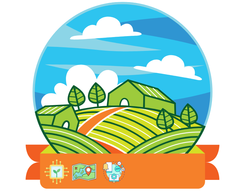
Digital Innovation in Agriculture Sector
Spread across Indonesia
Recorded digitally and accurately
Used by cooperatives & exporters
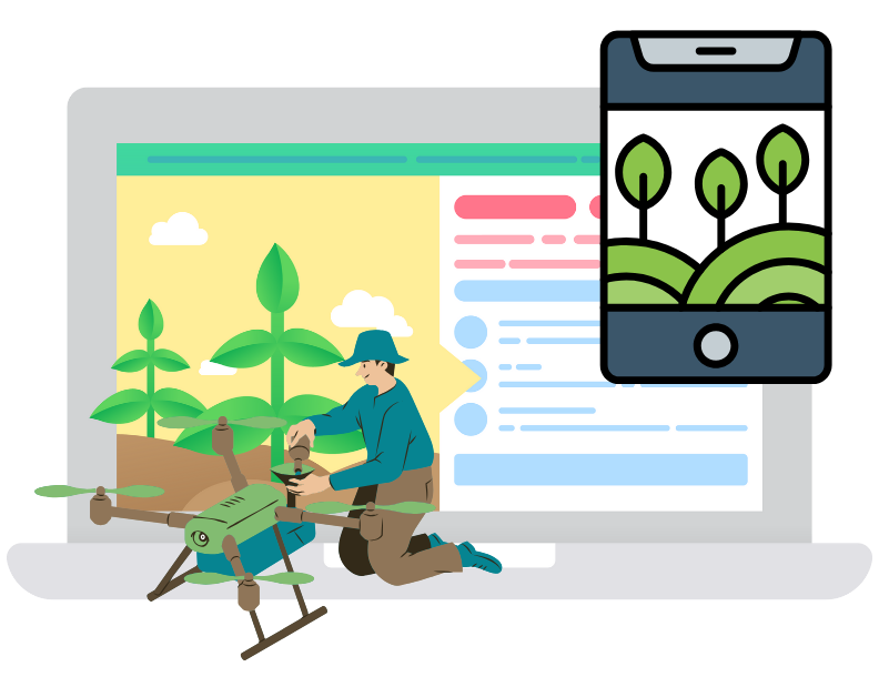
Tanduro is a digital platform designed to help farmers, cooperatives, and exporters efficiently manage plantations, record farmer and plantation data, and ensure compliance with EU regulations such as the EUDR (EU Deforestation Regulation). Through a map-based and real-time data approach, Tanduro promotes transparency and sustainability in the agriculture sector.
In digital plantation management & export reporting
Tanduro's features are designed to support sustainable plantation management and compliance with EUDR regulations.
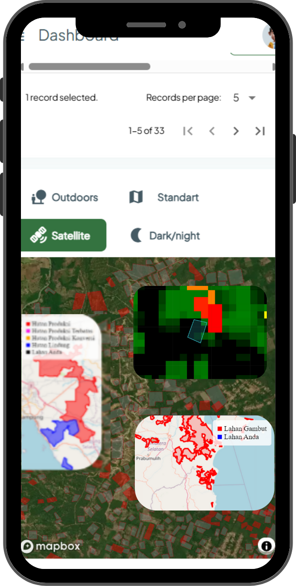
Tanduro ensures that plantations are free from deforestation after the EU's cut-off date through map-based and land use history analysis.
This feature allows farmers and plantation managers to digitally visualize plantation areas and integrate critical land and commodity data into a centralized system.
All data is automatically recorded, securely stored, and accessible anytime for reporting, audits, or data-driven decision making.

Plantation coordinates and farmer activities are automatically recorded via GPS for auditing and reporting purposes.
Deforestation analysis and land validation based on historical data and the latest land cover maps.
Drawing plantation boundaries, commodity input, and farmer management in one integrated system.
All agricultural activity data and analysis results can be exported for export reporting and certification.
Tanduro can be accessed via smartphones, tablets, and desktops for easy access to farmer and plantation data.
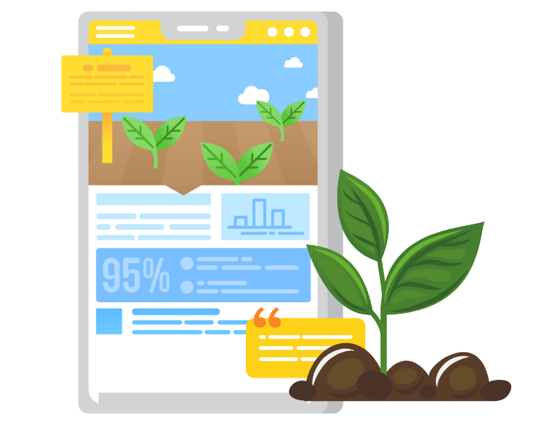
Activity reports, harvest results, and EUDR analyses can be downloaded in PDF format directly from Tanduro’s dashboard.
Every agricultural activity record is stored in real-time with GPS coordinate validation for traceability purposes.
All data is automatically stored in Tanduro’s cloud and can be accessed anytime, anywhere.
Tanduro’s display adapts to your device screen size for an optimal user experience.
All user data is encrypted and protected to ensure confidentiality and integrity of farmer information.
Join Tanduro to ensure your agricultural land meets global sustainability standards—from plantation mapping to automatic EUDR reporting. All in one digital platform.
Contact Us Now
Real experiences from Tanduro users in managing plantations, exports, and reporting efficiently and digitally.
Since using Tanduro, my plantation mapping has become more accurate. All activities like harvesting and fertilizing are automatically recorded, and I no longer worry about EUDR compliance.
Tanduro makes it easy for us to generate export reports in compliance with EU regulations. Land validation is done automatically, and reports are ready for audits in minutes.
Tanduro makes our farmer group data more organized. Member plantations can be monitored directly from the dashboard, and all data can be easily exported for government reports.
Using GPS and digital maps in Tanduro helps greatly during field surveys. Land data, legal status, and production results can be accessed directly and synchronized with headquarters.
Registered Farmers
Digitalized Plantations
Technical Support Hours
Regions Covered
Various digital solutions designed to increase productivity, compliance, and efficiency for farmers and plantation exporters.
Accurate land mapping using GPS and polygons makes it easy to track land status, ownership, and boundaries in real time.
Read MoreAutomatic analysis of deforestation status with cut-off data and documentation according to EU standards for sustainable exports.
Read MoreDigital recording of operational activities such as planting, harvesting, fertilizing, and plant maintenance to facilitate reporting and audits.
Read MoreMonitor plantation activities, farmer performance, legal status, and regulatory compliance through interactive dashboards and auto-generated export reports.
Read MoreChoose the package that suits your plantation management and EUDR compliance needs.
Perfect for small plantation owners who want to start digital mapping and initial data recording.
Ideal for farmer groups or cooperatives needing more comprehensive data integration.
A comprehensive solution for large plantation companies needing real-time data and complete reporting.
Here are some common questions regarding the use of our system to support EUDR compliance and digital plantation management.
EUDR (EU Deforestation Regulation) is an EU regulation to ensure that imported products do not come from deforested land. Compliance is crucial to keep your products eligible for the European market.
Tanduro uses GPS technology and satellite maps to create digital polygons of your plantations. This data is used for land cover analysis and location verification.
Yes, our system supports multi-plantation and multi-farmer management. You can manage all data centrally in one dashboard, including land information, harvest yields, and activity history.
Yes, all reports can be exported in formats ready for audits and shared with third parties such as buyers, auditors, or government agencies.
Your data is stored with high security standards on trusted cloud servers and can only be accessed by authorized parties. Privacy and data integrity are our priorities.
You can start by choosing one of our subscription packages, and our team will assist with onboarding, training, and initial mapping until the system is fully operational.
We are ready to help you develop technology solutions—from data management to smart system implementation. Contact us for a consultation.
Contact UsContact us for more information or if you have questions about services and system development collaboration.
We are ready to assist your needs in developing and implementing IT solutions professionally.
Technovate
District 8, Treasury Tower Lt. 6 Unit F Jl. Jend. Sudirman Kav. 52-53, SCBD Lot 28
+62 851-2115-4031
info@technovatecompany.co
Please send your message via the form below. We will respond as soon as possible.